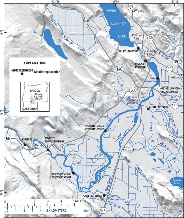
Water-Quality Monitoring and Modeling of the Keno Reach of the Klamath RiverStudy Area MapThe following map shows the Klamath River from Link River, just below Upper Klamath Lake, to the Keno Dam. That river reach is the specific area of interest for this study. The monitoring stations shown on the map are some of the specific sampling sites included in this investigation.
|
![]() U.S. Department of the Interior |
U.S. Geological Survey
U.S. Department of the Interior |
U.S. Geological Survey
URL: https://or.water.usgs.gov/proj/keno_reach/study_area_map.html
Page Last Modified: Saturday - Jul 6, 2024 at 14:47:19 EDT