Upper Klamath and Lost River Water Quality Monitoring and ModelingKlamath Straits Drain Area Project DataSeveral sites in the Klamath Straits Drain area have been sampled for water quality constituents starting in 2016. These sites include:
Lost River Project DataSeveral sites in the Lost River area have been monitored for water temperature, starting in 2021. These sites include:
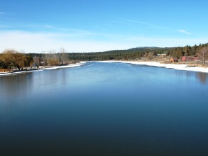
Upper Klamath River Project DataAn extensive data-collection plan was implemented for the Keno reach of the Klamath River in 2007 and continued in 2008, in concert with several experimental research thrusts. Data collection included acoustic Doppler current profiler (ADCP) measurements in the mainstem Klamath River and in four nearby canals as welll as weekly water-quality sample collection at five mainstem sites and five tributaries from early April through early November. Sampled constituents included field parameters (water temperature, pH, dissolved oxygen concentration, specific conductance); total nitrogen and phosphorus; particulate carbon and nitrogen; filtered orthophosphate, nitrite, nitrite plus nitrate, ammonia, organic carbon, iron, silica, and alkalinity; specific UV absorbance at 254 nm; phytoplankton and zooplankton enumeration and species identification; and bacterial abundance and morphological subgroups. The initial 2006-09 study has been completed, but additional research, monitoring, and modeling is ongoing. This page includes new data from the ongoing study. 2011 Macrophyte DataRooted aquatic plants (macrophytes) were sampled during three time periods in 2011 by the Bureau of Reclamation throughout the Link River to Keno Dam reach of the Klamath River. Those data supported an expansion of the water-quality model to include macrophytes and enhanced pH buffering. The data are described and used in the following report: Sullivan, A.B., Rounds, S.A., Asbill-Case, J.R.,
and Deas, M.L., 2013, Macrophyte and pH buffering updates to the Klamath
River water-quality model upstream of Keno Dam, Oregon: U.S. Geological
Survey Scientific Investigations Report 2013-5016, 52 p. The macrophyte data are available in spreadsheet form: Excel (67K). 2008 Data ReportThe 2008 data, as well as the sampling and analytical methods used to collect those data, are summarized in the following report: Sullivan, A.B., Deas, M.L., Asbill, J., Kirshtein,
J.D., Butler, K., and Vaughn, J., 2009, Klamath River water quality data
from Link River Dam to Keno Dam, Oregon, 2008: U.S. Geological Survey Open
File Report 2009-1105, 25 p. Data files are available for download through hyperlinks at the end of the report, or from this link: Appendixes A-D, or individually from the following links:
2007 Data ReportThe 2007 data, as well as the sampling and analytical methods used to collect those data, are summarized in the following report: Sullivan, A.B., Deas, M.L., Asbill, J., Kirshtein,
J.D., Butler, K., Wellman, R.W., Stewart, M.A., and Vaughn, J., 2008,
Klamath River Water quality and acoustic Doppler current profiler data
from Link River Dam to Keno Dam, 2007: U.S. Geological Survey Open File
Report 2008-1185. Data files are available for download through hyperlinks at the end of the report, or from the links below. Those data include:
|
![]() U.S. Department of the Interior |
U.S. Geological Survey
U.S. Department of the Interior |
U.S. Geological Survey
URL: https://or.water.usgs.gov/proj/keno_reach/data.html
Page Last Modified: Saturday - Jul 6, 2024 at 14:44:25 EDT