Oregon Water Science Center
Implications for Restoration and Monitoring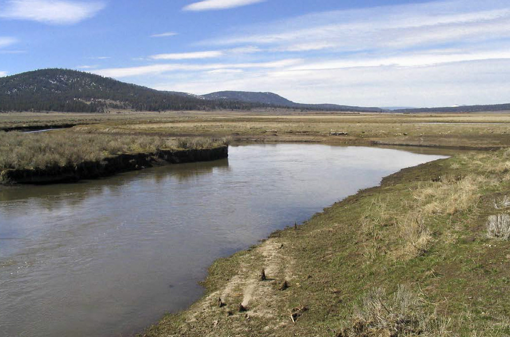
Lower Sprague River Valley. (Photograph by Jim O'Connor, USGS) As with other rivers (Jaquette and others. 2005; Wohl and others, 2005), understanding of historical conditions, trends, and channel and flood-plain processes can help in the design of effective restoration and monitoring strategies for improving ecological function of the Sprague River fluvial corridor. Consistent with the scale of our analyses, our assessment focuses on broadscale conditions, controls, and approaches, recognizing that some key ecologic issues are more appropriately considered at shorter timeframes and more local scales. Our assessment also emphasizes physical conditions, in line with our premise that geologic, geomorphic, and hydrologic processes provide the basic physical framework in which ecologic systems operate. Status and TrendsUnderstanding present conditions and historical trends clarifies restoration objectives, opportunities and constraints for the Sprague River fluvial system (table 13). Most importantly, it appears that most physical processes that have formed the present channel and flood plain have not been substantially altered at the basin scale. Although dynamic and reflective of watershed-scale factors such as climate, sediment production, and possibly land use, essential flow and sediment transport conditions have not been significantly changed. Consequently, key processes of lateral and longitudinal connectivity remain active. This contrasts with many western rivers in which dams and diversions have substantially affected basin-scale sediment and water fluxes, and where channel incision has limited interaction between channels and flood plains. Because these overall basin conditions have not been markedly altered, the historical conditions prior to extensive flood-plain and channel modification provide a plausible reference frame for restoration objectives. Although most important physical processes still function, systematic trends in channel and flood-plain conditions do indicate broadscale human influence. In particular, declining sinuosity, increased channel slope, decreased migration rates, local channel incision, and diminished short woody near-channel vegetation are probably the interrelated consequences of flood-plain and channel alterations. Channel confinement by levees and other built features is probably the single most important factor contributing to these changes, but the direct and indirect consequences of other manipulations, such as local flow diversion and concentration, grazing, vegetation removal, and beaver eradication, have also been important, particularly at the valley segment scale. Channel and flood-plain changes, including vegetation, were most evident for the period between 1940 and 1968, coinciding with increased use of heavy equipment for flood control and developing irrigation structures. The slowing of many of these trends between 1968 and 2000 indicates that reversal is possible and that some channel and flood-plain attributes could potentially be restored to near predevelopment conditions. This is particularly the case downstream of the confluence of the North Fork and South Fork Sprague River, where there has been little incision. For this broad area of the Sprague River study area, in which flood flows regularly inundate the flood plain, natural processes may be sufficient to reverse historical broad-scale trends, particularly if alterations such as flood-plain confinement, bank trampling, and bank hardening are lessened. Conditions are different in the eastern valley segments (table 13). Particularly for the South Fork valley segment, and to a lesser degree in the Upper Valley segment and possibly the North Fork segment, historical and ongoing channel incision and flood-plain erosion will inhibit reversal of historical trends and will likely continue to be a source of suspended sediment load to the river system. For the South Fork, incision will likely continue as long as the channel is fully constrained by levees and dikes and until knick zones and other erosional areas progress to locations where channel and flood-plain substrate resists continued down-cutting and gully expansion. Current and historical trends are not likely to reverse until a more natural channel and flood-plain geometry is attained and the channel aggrades to the extent that overbank flow becomes common. Spatial and Temporal ScalesThe mapping, stratigraphic investigations, and quantitative channel and flood-plain analyses provide context for restoration objectives and approaches to monitoring. Most broadly, the geomorphic flood plain is the domain of nearly all key hydrologic and geomorphic processes shaping the channel and flood plain. Some areas outside the geomorphic flood plain are inundated by flooding, particularly some areas of main-stem valley fill, but it is solely the geomorphic flood plain that has been subject to channel forming processes for the last several thousand years. Consequently, the greatest likelihood of restoration to pre-development conditions would result from a strategy emphasizing natural processes for the entire geomorphic flood plain. Historically, most channel processes operated within narrow corridors, therefore it may be possible to reverse historical changes in the channel by focusing on more limited areas adjacent to the present channel. Such a strategy, however, carries some risk, since avulsions and cutoffs, which create ecologically important flood-plain features, require access to areas outside of the near-channel environment. The valley segments also provide a spatial context for restoration and monitoring. Conditions, trends, and processes vary markedly among the segments (table 13), and restoration strategies are likely to be most successful if tailored to specific segments and the important processes and conditions within those segments. For example, the fundamental changes to the South Fork valley segment, such as the channel straightening and incision, leave it unlikely to recover natural process regimes and morphologies without active manipulation, possibly including relocating the channel and increasing sinuosity, whereas other valley segments would likely achieve high levels of channel and flood-plain function by adoption of more passive strategies such as riparian corridor protection and levee breaching. More broadly, the unconfined and confined segments have different vegetation characteristics, morphologies and process regimes. Most of the declines in sinuosity are in the unconfined valley segments (figure 60), in part because these segments have been locally confined by levees and railroad grades. All segments have lost short woody vegetation, but percentagewise, the losses have been greatest in the unconfined valley segments, particularly in near-channel areas (figures 61 and 62). The unconfined segments historically and presently had very little woody cover aside for the now-diminished short-woody riparian species. By contrast, the confined segments along the main-stem Sprague River were historically and are presently more covered with woody vegetation and are the primary sources of large wood to the fluvial system. These trends and attributes could point to segment-specific restoration approaches and objectives to vegetation management. An important temporal aspect of the Sprague River study area is that geomorphic processes are slow. The low slopes, low bed-material supply and transport rates, and low stream powers all result in naturally slow rates of channel and flood-plain evolution. In particular, rates of channel migration, meander enlargement (increasing sinuosity), lateral and vertical flood-plain building, and short woody vegetation recovery are likely to be slow processes under passive management scenarios. Consequently, restoration objectives dependent on natural processes may take longer to achieve than for more energetic and sediment-rich fluvial systems more typical in western North America. Sediment and flow regimes have naturally changed in the Sprague River study area over the last several thousand years. These natural dynamics have affected overall flood-plain morphology and rates and processes of channel movement. At millennial time scales, the Sprague River fluvial system is still responding to the 7,700 cal yr BP eruption of Mount Mazama and the resulting loading of the watershed with sand- and granule-sized pumice. Over thousands of years, the effects of this sediment will diminish, and, in the absence of a similar large-scale disturbance, it is likely that the Sprague River fluvial system will revert to a more fine-grained wet meadow system as indicated by the character of pre-Mazama flood-plain deposits. At these long time scales, the unconfined valley segments (and adjacent main-stem valley fills) are likely to continue to aggrade slowly from overbank flood plain deposition and slow channel migration across the flood plain. At shorter and more relevant timescales for restoration, natural flood plain and channel dynamics are likely to affect channel and flood-plain conditions. In particular for the North Fork and Lower Sycan valley segments, stratigraphic records show multiple cycles of flood plain erosion and deposition over the last 2000 years, including a current phase of flood-plain building over the last 300–600 years. These episodes of flood-plain formation and erosion, possibly in conjunction with minor channel incision and aggradation, likely reflect changes in watershed sediment and flow conditions, possibly resulting from climate variability (Lind, 2009). Additionally, the North Fork valley segment has also apparently alternated between a channelized fluvial corridor and wet meadow fluvial system before reverting to its current channel and flood-plain morphology. These dynamics reflect natural ranges of behavior and morphology and could be reflected in restoration objectives aiming for natural process regimes. Key Process RegimesBecause natural variability and complexity is ubiquitous and incompletely understood for physical and ecologic processes and interactions involving rivers, restoration of processes may be more likely to successfully achieve ecologically based rehabilitation goals than restoration to predefined end points (Wohl and others, 2005; Palmer and others, 2005; Bernhardt and Palmer, 2011). For the Sprague River, we have identified three key and interrelated process regimes historically important to flood-plain and channel form and function: (1) channel migration (including avulsions and cutoffs), (2) overbank flooding, and (3) vegetation succession and disturbance. Maintaining these processes would likely result in long-term channel and flood-plain conditions consistent with regional ecologic objectives (National Research Council, 2004) for much of the study area. Channel migration builds much of the near-channel environment, creates sinuosity, results in bar deposition and bank erosion, and creates much of the topography of the geomorphic flood plain. Channels abandoned by avulsions and cutoffs become side channels and wetlands. Channel migration creates suitable substrates and colonization areas for aquatic and near-channel flora and fauna. Specific habitat features include in-channel pools and riffles, channel-flanking gravel patches and bars, young and low flood-plain surfaces, and eroding banks, where down-dropped blocks create local and variable habitat conditions. For the Sprague River and its major tributaries, channel migration is likely a self-perpetuating process; lateral erosion provides sediment that builds bars and inner banks, which in turn steer currents against outer banks, promoting lateral erosion. Sinuosity in the Sprague River study area results from the competing processes of meander enlargement by lateral channel migration and avulsions, and cutoffs that truncate or by-pass meander loops. The decreased sinuosity since 1940 (figure 60) likely owes to avulsions and cutoffs forming at rates faster than compensating channel migration, perhaps as a consequence of channel confinement by levees, dikes, and other flood-plain disturbances. Migration rates have also slowed historically (figure 60), perhaps also due to levee confinement and local bank protection. Recent restoration projects have aimed to restore sinuosity by plugging cutoffs and avulsion channels and placing channels back into former meander loops, locally buttressed by various forms of armoring (figure 23). But, instead of attempting to reverse specific cutoffs, a more sustainable long-term approach aligned with native processes would be to allow sinuosity to increase at broad scales by (1) allowing lateral channel migration in all practical locations and (2) limiting disturbances promoting avulsions and cutoffs, such as confinement, ditches, and trails. Under such natural equilibrium conditions, cutoffs and avulsions will persist, forming side channels and flood-plain wetlands and thereby increasing habitat diversity, but sinuosity will be maintained by continued lateral channel migration. Overbank flooding is also an important process in the Sprague River study area, and is a key component of hydrologic connectivity within the fluvial system (Kondolf and others, 2006). Overbank flooding disperses suspended sediment, augments flood-plain soils, incrementally builds flood-plain surfaces, and promotes lateral exchanges of nutrients, flora, and fauna (Jenkins and Boulton, 2003). Hydraulic consequences include attenuation of flood peaks and lowering in-channel flow velocities during floods (possibly limiting channel widening). Overbank flow is required for chutes and avulsions, the primary mechanisms by which meanders are cut off and abandoned, leading to side- and off-channel aquatic habitats. For most of its length, the Sprague River has retained a degree of both lateral and longitudinal connectivity. Dams and diversions have been removed from the mains-stem Sprague River, leaving only a few such structures in the South Fork and North Fork valley segments. Overbank flooding is still common, as evident by the extensive flood-plain inundation during the 2006 high flows, but has been limited in some reaches by levees, dikes, and railroad grades, and in the South Fork valley segment by channel incision. The general absence of significant incision for much of the study area; however, has preserved the viability of overbank flooding, thereby enhancing overall restoration potential by passive management approaches, including strategic levee removal and breaching, which could enhance lateral connectivity. Vegetation succession and disturbance processes interact to create the mosaic of riparian and flood-plain vegetation. Vegetation is important in affecting bank stability and geometry, stream shading (and temperature), bank and flood-plain nutrient conditions, in-stream wood loading, and resistance of channel edges and flood-plain surfaces to erosion and channel formation. Although significant trends are evident in cover type in the study area (table 13; figures 61, 62, 63, 64, 65, and 66), probably reflecting changes in types of intensity of disturbance, the basic vegetation types and distributions are similar to those in the early historical descriptions. The likelihood of attaining riparian vegetation patterns broadly similar to historical conditions is, therefore, high for most of the study area if the rates and types of disturbance processes revert to more natural conditions, particularly for the more dynamic near-channel environments. The greater proportion of advancing seral stages in the 1968–2000 period compared to the 1940–1968 period (figure 64) indicates that vegetation can respond at decadal time scales to changes in human disturbance factors. Less evident is whether active vegetation management strategies such as planting are effective in restoring vegetation conditions. Such efforts are particularly challenging in dynamic near-channel environments, where channel migration, flooding, predation, erosion, and deposition can adversely affect planted vegetation, although low migration rates in some reaches may enhance survival. Many recent restoration projects have involved efforts to establish shrubs and trees, but these have been mostly unsuccessful, possibly because of high water tables (Rasmussen, 2011). Controlling factors such as sediment transport, channel migration, and regular flood-plain inundation are still present for most of the Sprague River study area, and intense manipulation or active vegetation management may not be necessary to achieve ecologically based vegetation objectives. An uncertain factor, however, is the presence of reed canary grass, now extensive in several segments in the basin. This nonnative species will likely affect restoration efforts by decreasing potential for shrub germination and displacing native herbaceous species, particularly in areas of reduced grazing intensity. Processes identified as important for creating and maintaining ecologically beneficial channel and flood-plain conditions still function in most of the study area, although some at altered levels. Consequently, our judgment is that substantial flood-plain and channel manipulation is not required to meet most ecologically based objectives at the broad scales of the geomorphic flood plain and valley segments. An exception to this general passive approach might be in regards to levees and dikes, which have locally confined the channel and for which strategic breaching may enhance lateral connectivity and reduce incision potential. In the South Fork valley segment, however, the key processes and conditions have been substantially altered by diversions, channelization, incision, levee construction, and vegetation manipulation and removal. Geomorphic and ecologic changes of the last 100 years cannot likely be reversed without substantial manipulation of the channel and flood plain. Even with alterations so that channel migration, overbank flooding, and vegetation secession can proceed, the naturally slow rates of these processes for the Sprague River will likely require decades or centuries for reestablishment of the early 1900s conditions in the South Fork of wet meadows interspersed with luxuriantly vegetated riparian corridors. Restoration ObjectivesThe results of this study provide means for establishing measureable broadscale objectives pertaining to important geomorphic and ecologic processes. This perspective is based on the premise that maintaining and enhancing the key process regimes will broadly enhance ecological conditions in the Sprague River basin. Consequently, restoration objectives follow from the key process regimes identified here. This approach contrasts with objectives focused on site-specific channel and flood-plain conditions, although this might be appropriate for key habitats at special locations. One objective could be to maintain, allow, or restore natural channel migration processes, including cutoffs and avulsions, which can be measured in terms of sinuosity, slope, width, migration rates, and bar area. Sinuosity integrates many of these factors, but channel migration rates are an index of channel dynamics, which also underlie many important channel and flood-plain attributes. A second objective could focus on maintaining and enhancing frequency and extent of overbank flooding and lateral connectivity. In unincised and unconstrained segments, a logical objective would be to maintain the present frequency and extent of flooding. Where the channel is incised, an increase in the frequency and extent of flooding would indicate a tendency toward more natural conditions. In these areas, locally increasing channel and flood-plain elevations indicate channel and flood-plain aggradation, consistent with overbank flooding and exchange of sediment and nutrients between the channel and flood plain. Similarly, a diminishing vertical difference between channel and flood-plain elevation indicates more frequent inundation for a given flood regime. In sections where flooding has been limited by structures such as levees or railroad grades, decreasing the extent of the geomorphic flood plain separated from channel and flood-plain processes by levees, dikes, and other structures would lead to more natural conditions and increase the extent of flooding. Along these lines, dike and levee removal or breachingis one of the very few restoration activities requiring active flood-plain manipulation. Broadscale vegetation objectives derived from this study could emphasize the distribution and extent of specific cover types, transitions among cover types, or more general successional or disturbance trends. Because historical and present vegetation conditions vary spatially, such objectives could likely be most usefully established if designed for individual valley segments and separately for near-channel and flood-plain areas. These smaller areas would also likely be the best candidates for objectives pertaining to individual species, as described more fully by Rasmussen (2011). Whereas all of these types of objectives are relevant to important channel and flood-plain processes and conditions in the Sprague River study area, they may not directly signal trends in the overall regional objectives of restoring endangered fish species and improving water quality (Oregon Department of Environmental Quality, 2002; National Research Council, 2004; National Resource Conservation Service, 2009). Nevertheless, trends in these indicators will almost certainly relate to overall ecologic integrity and the basin’s general ability to provide ecological services, although such attributes may be difficult to characterize quantitatively. Monitoring ApproachesQuantification of these objectives and their attainment could be derived from the types of analyses described here that provide information on decadal-scale trends. Repeat mapping of plan-view channel morphology, channel migration rates, and vegetation conditions from new aerial photographs, using the protocols employed by this study, would allow for direct comparison and measurements of key features used to measure the success of restoration objectives or document other changes following future disturbances, such as large floods (figure 60). New and repeated LiDAR acquisitions would also facilitate efficient broadscale monitoring, especially if the coverage and quality meet that of the 2004 LiDAR. Topographic analyses of channel and flood-plain surfaces, by comparison with previous LiDAR elevation data, would allow for monitoring channel and flood-plain aggradation and erosion, thereby effectively tracking connectivity between the channel and flood plain. Additionally, by enabling detection of changes in bar and flood-plain sediment volumes, valley-segment and basin-scale sediment budgets could be determined if coupled with long-term sediment measurement programs (for example, Gran and others, 2009). Techniques are also developing for quantitative characterization of vegetation types and density from LiDAR elevation data (Forzieri and others, 2010; Pflugmacher and others, 2011), which could enable more quantitative measurement of vegetation trends. Consistent with all aspects of this study, these types of monitoring approaches are most applicable to broad temporal and spatial scales. Such broadscale monitoring is not likely to discern immediate effects of site-specific restoration activities, but should be able to document trends resulting from the cumulative effects of activities at the scale of valley segments or the entire study area. Similarly, because geomorphic processes are slow in the Sprague River basin, such monitoring would most efficiently be conducted at decadal time scales, thereby allowing detection of trends and conditions as they respond to flood-plain management actions in reaction to a range of hydrologic and geomorphic events over several years. Additionally, monitoring of the effects of significant flows, such as conducted in this analysis of the 2006 high flows, would enable continued assessment of the efficacy of key channel and flood-plain processes during geomorphically effective events. |
Contents:
For more information, contact: Director, Oregon Water Science CenterU.S Geological Survey 2130 SW 5th Ave Portland, OR 97201 Phone: (503) 251-3200 E-mail: info-or@usgs.gov Part or all of this report is presented in Portable Document Format (PDF); the latest version of Adobe Reader or similar software is required to view it. Download the latest version of Adobe Reader, free of charge. |
![]() U.S. Department of the Interior |
U.S. Geological Survey
U.S. Department of the Interior |
U.S. Geological Survey
URL: https://or.water.usgs.gov/proj/Sprague/report/section_9.html
Page Contact Information: Oregon Webteam
Page Last Modified: Tuesday, 11-Jun-2013 19:50:55 EDT
