Oregon Water Science Center
|
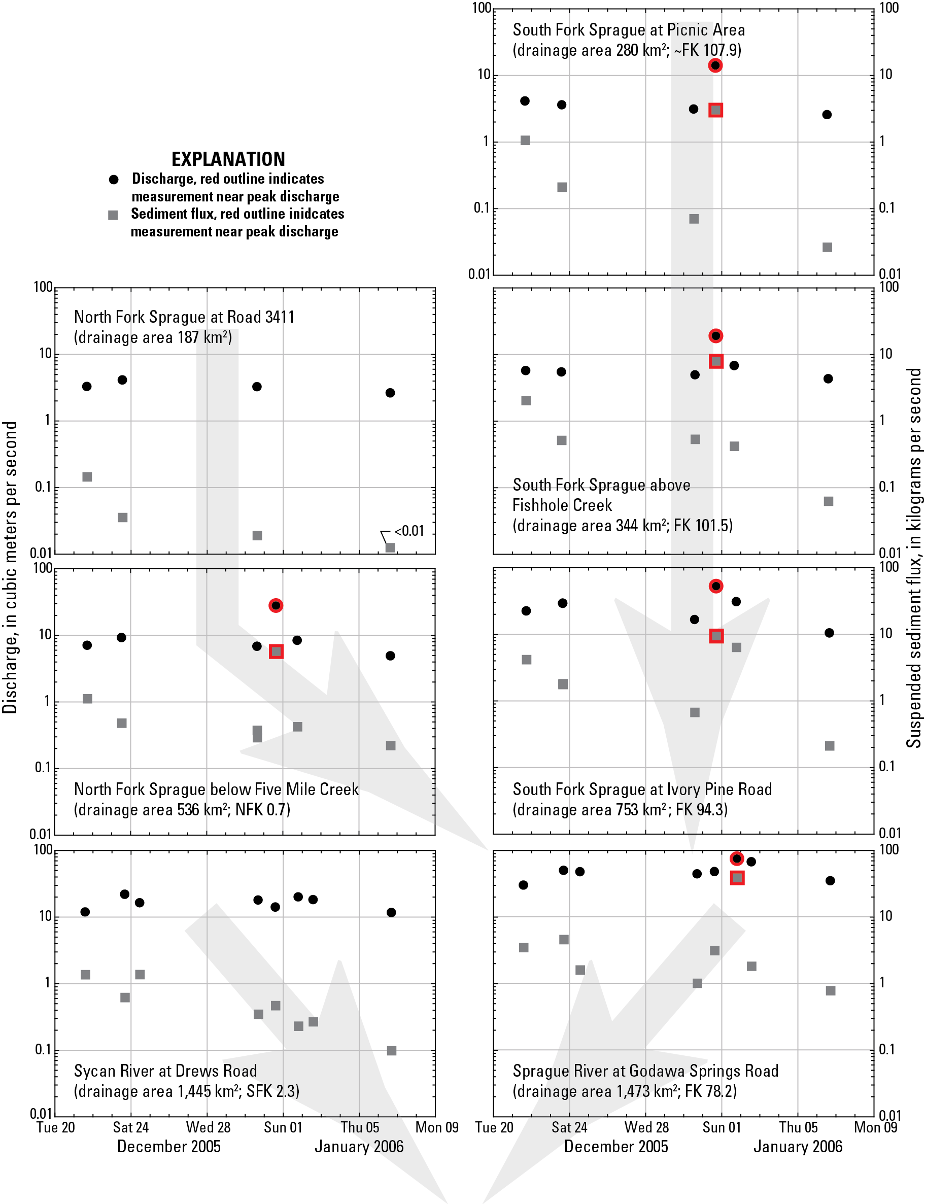
Figure 55. Discharge and suspended sediment transport between the 20 Dec 2005 and 7 January 2006 period of high flows for seven locations in the Sprague River basin. Measurements near peak discharge are indicated by red outlines. Grey arrows indicate stream network relations. Source: Graham Mathews and Associates (2007). 
|
Contents:
For more information, contact: Director, Oregon Water Science CenterU.S Geological Survey 2130 SW 5th Ave Portland, OR 97201 Phone: (503) 251-3200 E-mail: info-or@usgs.gov Part or all of this report is presented in Portable Document Format (PDF); the latest version of Adobe Reader or similar software is required to view it. Download the latest version of Adobe Reader, free of charge. |