Oregon Water Science Center
|
Figure 52. Summary observations of a 2006 survey of deposits and inundation levels of water year 2006 high flows along the main-stem Sprague River. No observations were made in the Chiloquin Canyon valley segment. All elevations are adjusted to the stage associated with an 11.5 m3/s discharge at USGS streamflow-gaging station Sprague River near Chiloquin (station number 11501000). A. Longitudinal trends of deposits and inundation evidence. Peak flow values from Sprague River near Chiloquin and Sprague River near Beatty (11497500); peak flow at both sites was Jan. 1, 2006. B. Summary plots of 2006 flood deposit texture and elevation grouped by bar and flood-plain settings. 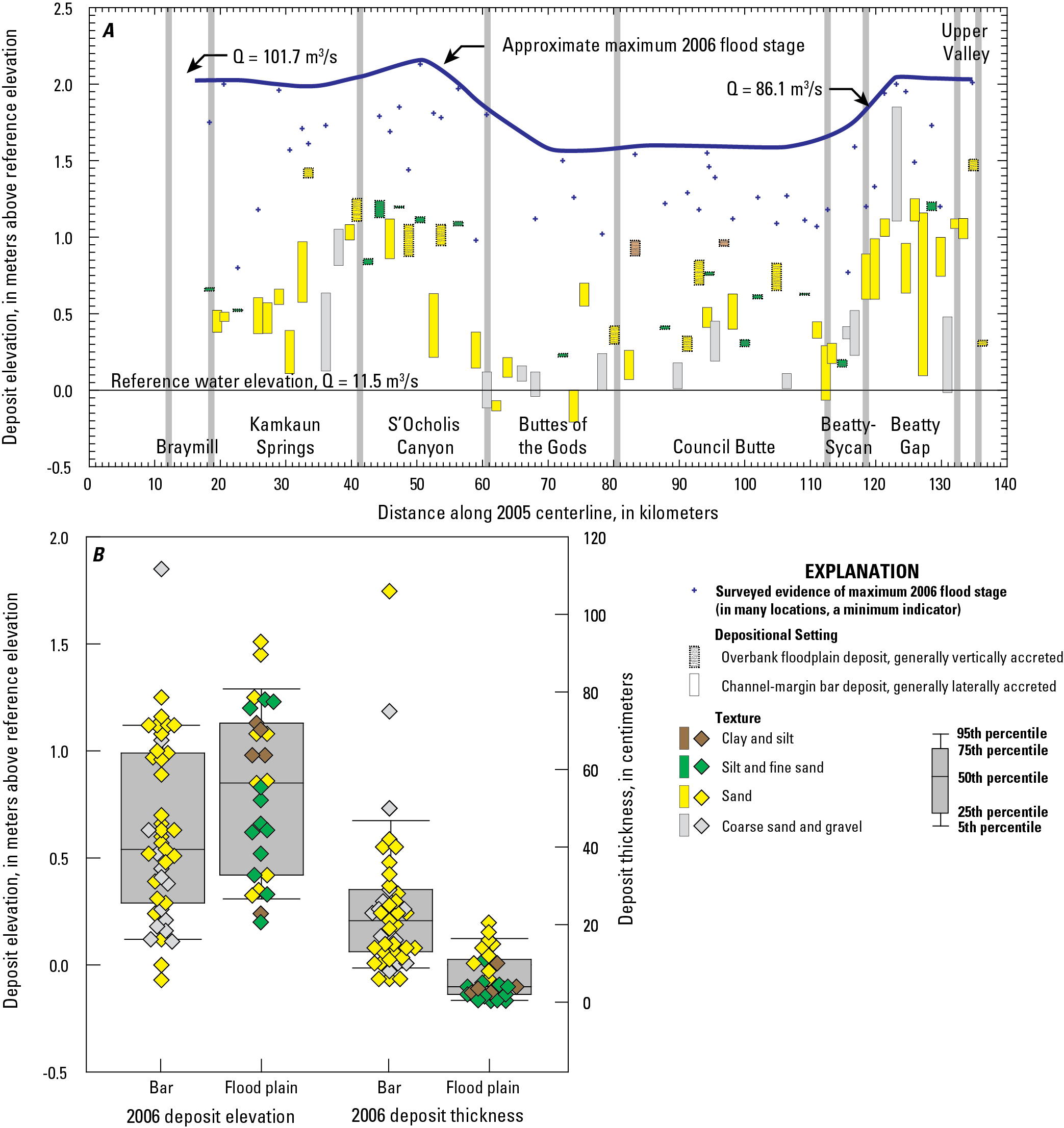
|
Contents:
For more information, contact: Director, Oregon Water Science CenterU.S Geological Survey 2130 SW 5th Ave Portland, OR 97201 Phone: (503) 251-3200 E-mail: info-or@usgs.gov Part or all of this report is presented in Portable Document Format (PDF); the latest version of Adobe Reader or similar software is required to view it. Download the latest version of Adobe Reader, free of charge. |
![]() U.S. Department of the Interior |
U.S. Geological Survey
U.S. Department of the Interior |
U.S. Geological Survey
URL: https://or.water.usgs.gov/proj/Sprague/report/Figures/fig52.html
Page Contact Information: Oregon Webteam
Page Last Modified: Monday, 03-Jun-2013 19:10:09 EDT
