Oregon Water Science Center
|
Figure 49. Spatial trends in channel-centerline elevation differences as mapped from 2004 (LiDAR) in conjunction with sequential channel centerline positions, as mapped from GLO maps and aerial photographs from 1940, 1968, 1975, 2000, and 2005. Measurements at flood-plain transects are spaced at 200 m. GLO to 1940 channel-elevation differences determined only for parts of Council Butte and BeattySycan valley segments where channel was meandered. Observations from South Fork, North Fork, Lower Sycan, and Coyote Bucket are limited for some time periods by incomplete map and photo coverage. 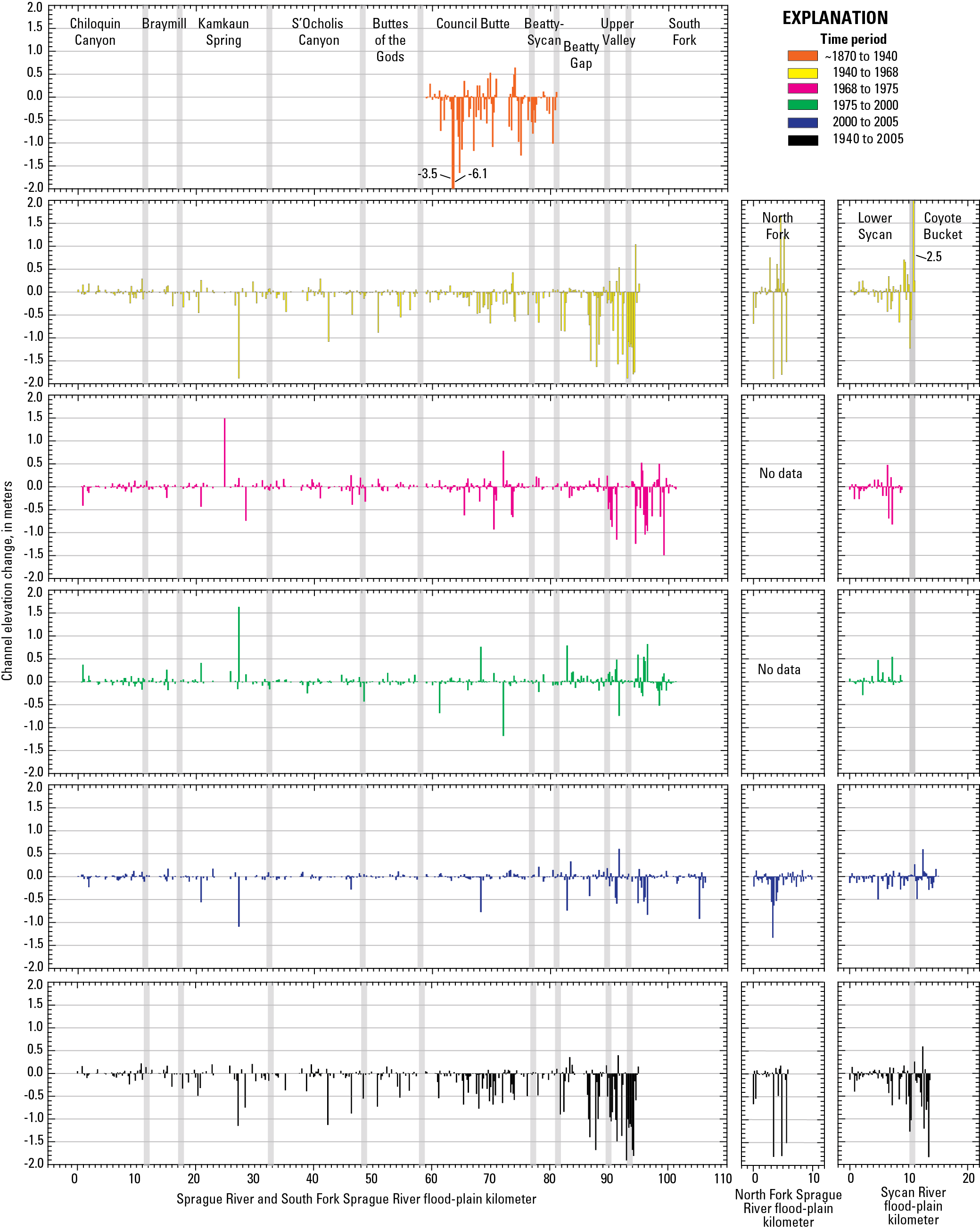
|
Contents:
For more information, contact: Director, Oregon Water Science CenterU.S Geological Survey 2130 SW 5th Ave Portland, OR 97201 Phone: (503) 251-3200 E-mail: info-or@usgs.gov Part or all of this report is presented in Portable Document Format (PDF); the latest version of Adobe Reader or similar software is required to view it. Download the latest version of Adobe Reader, free of charge. |
![]() U.S. Department of the Interior |
U.S. Geological Survey
U.S. Department of the Interior |
U.S. Geological Survey
URL: https://or.water.usgs.gov/proj/Sprague/report/Figures/fig49.html
Page Contact Information: Oregon Webteam
Page Last Modified: Monday, 03-Jun-2013 19:08:13 EDT
