Oregon Water Science Center
|
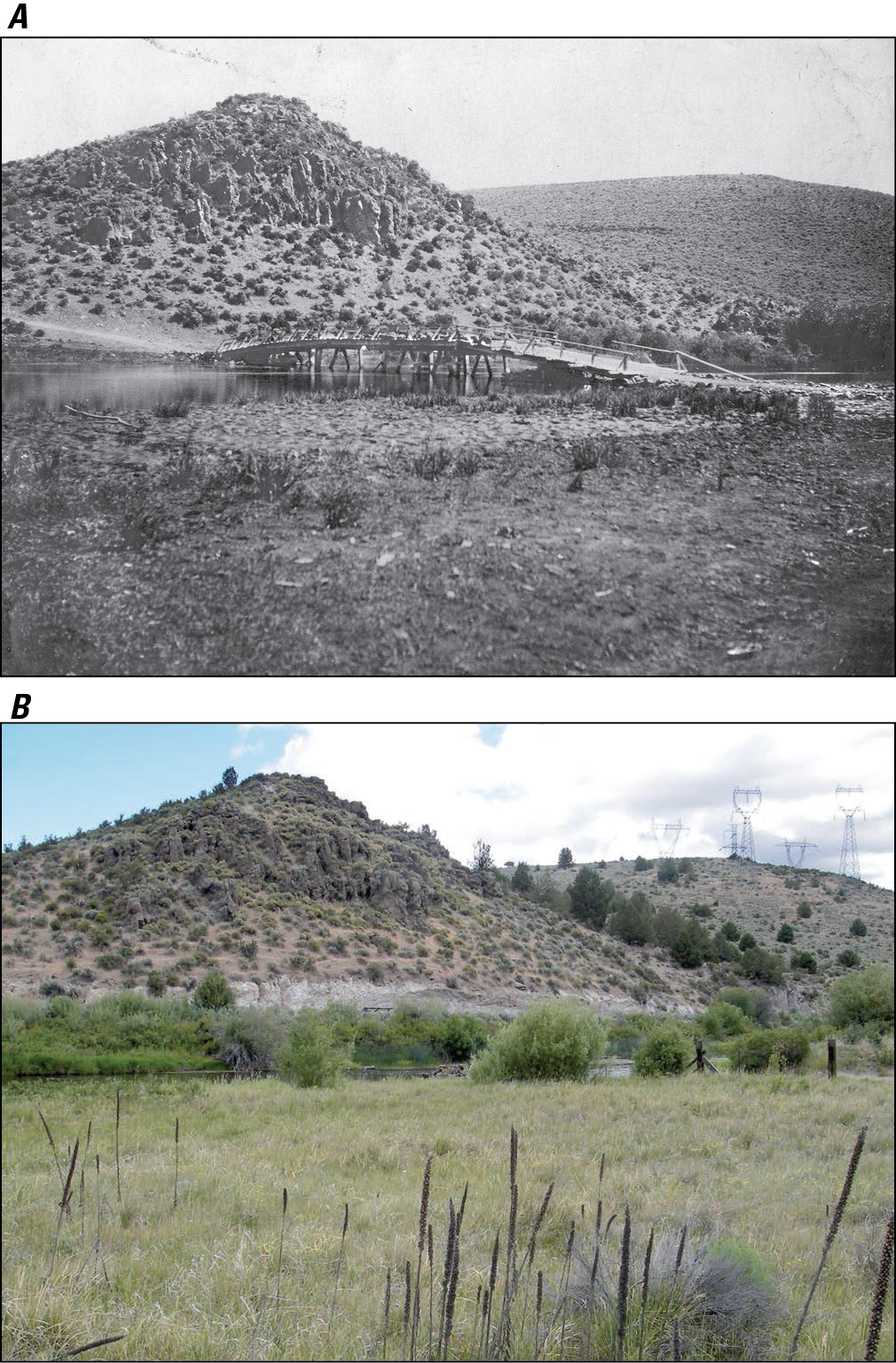
Figure 29. Approximately matched photograph pair at FK 81.4 near the downstream end of the Beatty Gap valley segment. A. Bureau of Reclamation photograph of former Beatty Bridge location, probably from 21 May 1904 establishment of short-lived streamflow-gaging station near present site of Oregon Water Resources Department station 11497500 (Klamath Waters Digital Library; http://digitallib.oit.edu/cdm/singleitem/collection/kwl/id/522/rec/5, accessed 11 February 2012). B. Photograph made 29 June 2007 from similar location, showing increase of riparian willow, hillslope juniper, and transmission towers.
|
Contents:
For more information, contact: Director, Oregon Water Science CenterU.S Geological Survey 2130 SW 5th Ave Portland, OR 97201 Phone: (503) 251-3200 E-mail: info-or@usgs.gov Part or all of this report is presented in Portable Document Format (PDF); the latest version of Adobe Reader or similar software is required to view it. Download the latest version of Adobe Reader, free of charge. |
![]() U.S. Department of the Interior |
U.S. Geological Survey
U.S. Department of the Interior |
U.S. Geological Survey
URL: https://or.water.usgs.gov/proj/Sprague/report/Figures/fig29.html
Page Contact Information: Oregon Webteam
Page Last Modified: Monday, 03-Jun-2013 18:43:23 EDT