Oregon Water Science Center
|
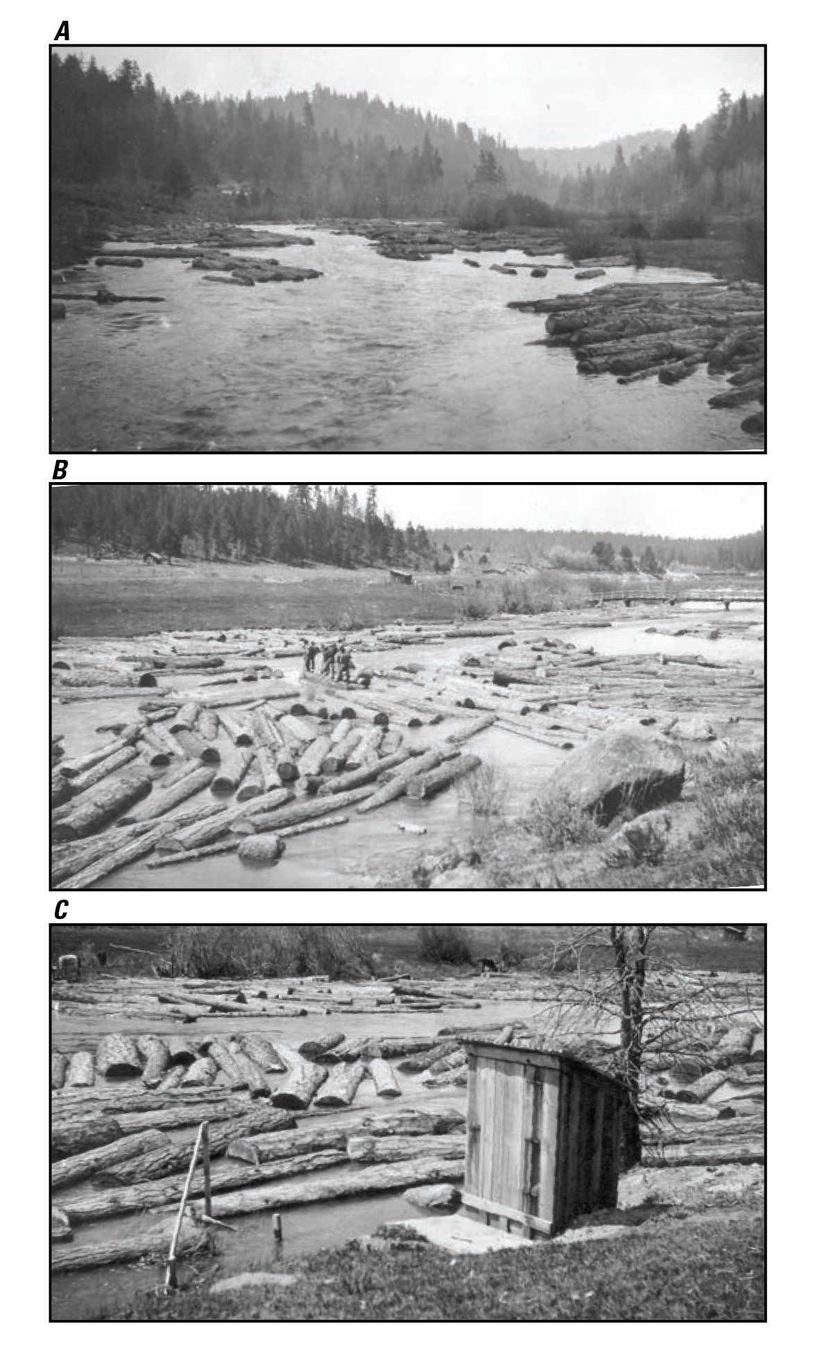
Figure 20. Historical photographs associated with former U.S. Geological Survey (USGS) streamflow-gaging station 11502000, near Chiloquin at FK 0.7, showing substantial saw-log transport. Photographs from USGS Oregon Water Science Center files. A. 2(?) May 1918 view upstream from former wagon bridge crossing of the Sprague River at FK 0.7 (date not specifically noted, but indicated by accompanying notes). B. 6 May 1918 view downstream from near USGS gage-house location; bridge visible in upper right of image. C. 6 May 1918 view of USGS gage house on right bank of Sprague River near FK 0.7.
|
Contents:
For more information, contact: Director, Oregon Water Science CenterU.S Geological Survey 2130 SW 5th Ave Portland, OR 97201 Phone: (503) 251-3200 E-mail: info-or@usgs.gov Part or all of this report is presented in Portable Document Format (PDF); the latest version of Adobe Reader or similar software is required to view it. Download the latest version of Adobe Reader, free of charge. |
![]() U.S. Department of the Interior |
U.S. Geological Survey
U.S. Department of the Interior |
U.S. Geological Survey
URL: https://or.water.usgs.gov/proj/Sprague/report/Figures/fig20.html
Page Contact Information: Oregon Webteam
Page Last Modified: Monday, 03-Jun-2013 18:37:26 EDT