Oregon Water Science Center
|
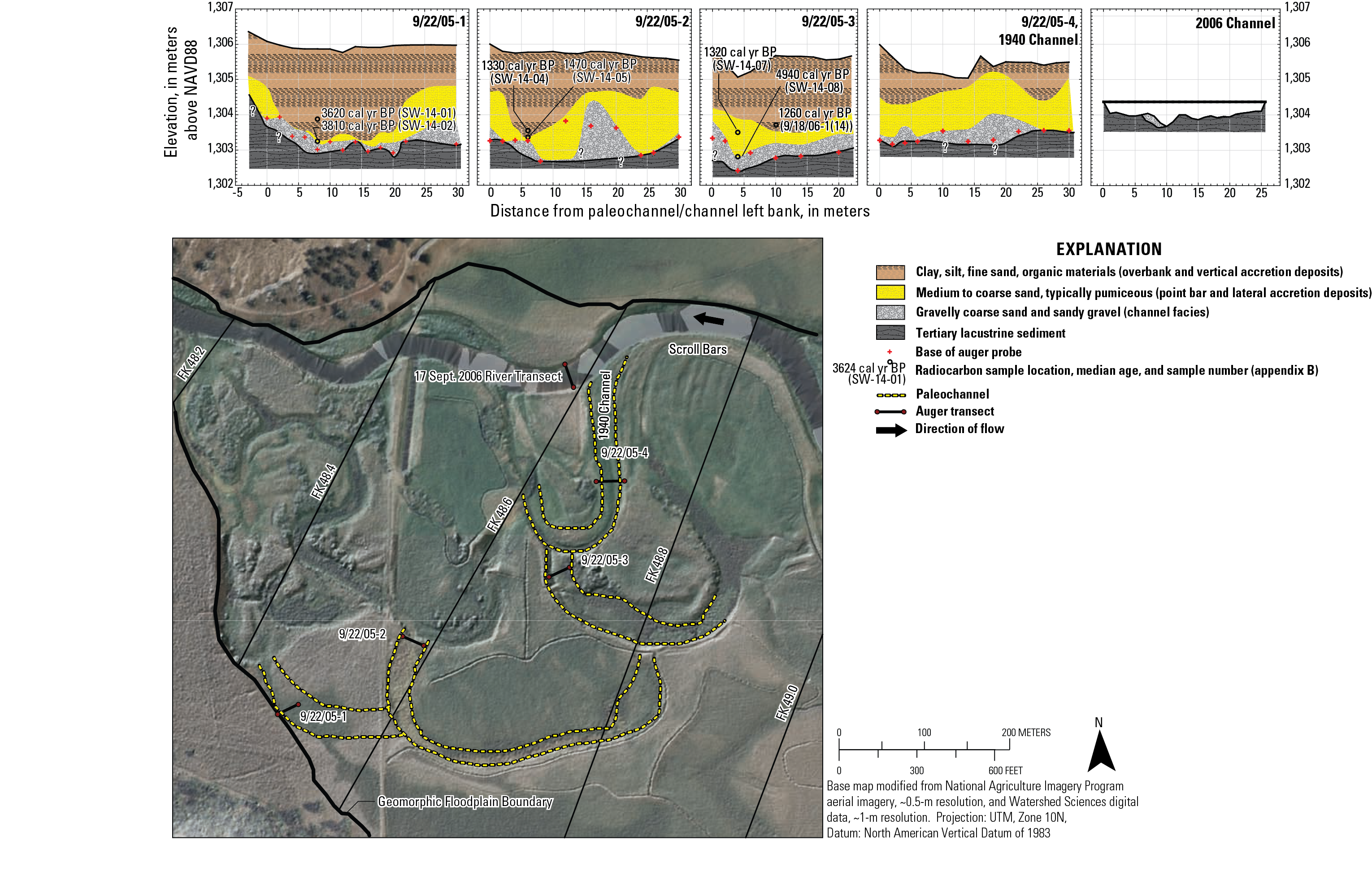
Figure 12. Former paleochannel locations and augering transects between flood-plain kilometer 48.2 and 49.0 in Buttes of the Gods valley segment. Auger transect 4 crossed the location of the channel as shown in the 1940 aerial photographs. Scroll bars indicate the downstream translation of the 1940 meander loop prior to cut.
|
Contents:
For more information, contact: Director, Oregon Water Science CenterU.S Geological Survey 2130 SW 5th Ave Portland, OR 97201 Phone: (503) 251-3200 E-mail: info-or@usgs.gov Part or all of this report is presented in Portable Document Format (PDF); the latest version of Adobe Reader or similar software is required to view it. Download the latest version of Adobe Reader, free of charge. |
![]() U.S. Department of the Interior |
U.S. Geological Survey
U.S. Department of the Interior |
U.S. Geological Survey
URL: https://or.water.usgs.gov/proj/Sprague/report/Figures/fig12.html
Page Contact Information: Oregon Webteam
Page Last Modified: Tuesday, 18-Jun-2013 20:19:55 EDT
