Temperature Effects of Point Sources, Riparian Shading, and Dam Operations on the Willamette RiverRiparian Shading
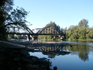
"System potential" vegetation, or the potential near-stream land cover, is the mature vegetation that should occur at a particular location, based on the soils and geologic materials that occur there. ODEQ conducted a study of potential near-stream land cover as part of the Willamette River temperature TMDL, and the results were used to predict the height and shading characteristics of system potential vegetation along the banks of all modeled river reaches (Oregon Department of Environmental Quality, 2006). System potential vegetation was used in the modeling of Natural Thermal Potential baseline conditions in the TMDL and in this investigation. System potential shade input files for the models were used as received from ODEQ; shade files representing current conditions were obtained from PSU as used in the latest model calibration runs. Model results showed that restoring all riparian shading along the Long Tom River could cool the Willamette River at its point of inflow by approximately 0.03oC, which is small but potentially useful for heat-load trades with some of the point sources upstream of Albany. Shade restoration along selected 5-mile reaches of the Willamette River upstream of Albany showed cooling effects as large as 0.19oC at certain locations. A 5-mile reach can be traversed in a few hours, however, which caused the cooling effects to exhibit a nodal pattern with downstream distance. The cooling effect was minimal at one-half day of travel time downstream of the restored reach because the water passed by that reach during the night when shading does not particularly affect the heat budget of the river. This pattern in downstream cooling effects has potentially important ramifications for heat-load trading and the siting of riparian restoration projects. For more information and discussion of results, see the USGS report:
Rounds, S.A., 2007, Temperature effects of point sources, riparian shading,
and dam operations on the Willamette River, Oregon: U.S. Geological Survey
Scientific Investigations Report 2007-5185, 34 p.
|
![]() U.S. Department of the Interior |
U.S. Geological Survey
U.S. Department of the Interior |
U.S. Geological Survey
URL: https://or.water.usgs.gov/proj/will_temp/shading.html
Page Contact Information: Stewart Rounds
Page Last Modified: Wednesday - Jan 9, 2013 at 19:35:40 EST