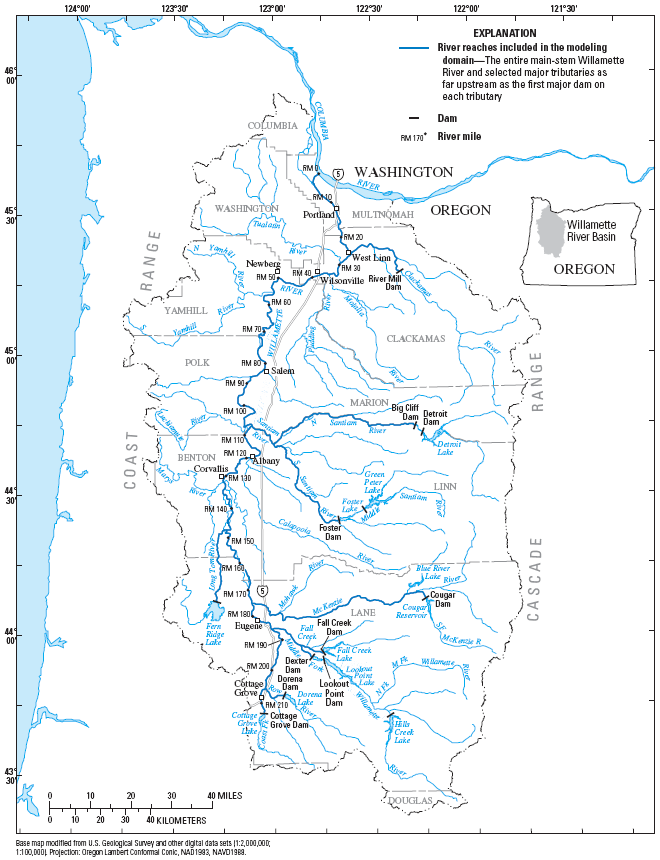
Temperature Effects of Point Sources, Riparian Shading, and Dam Operations on the Willamette RiverMap of the Willamette River BasinThis map of the Willamette River basin shows the river network, the modeled river reaches, and the location of the major reservoirs. The modeled river reaches are shown in a slightly darker blue color, while unmodeled reaches are shown in a light blue color.
|
![]() U.S. Department of the Interior |
U.S. Geological Survey
U.S. Department of the Interior |
U.S. Geological Survey
URL: https://or.water.usgs.gov/proj/will_temp/map.html
Page Contact Information: Stewart Rounds
Page Last Modified: Wednesday - Jan 9, 2013 at 19:35:35 EST