Columbia River Basalt Stratigraphy in the Pacific Northwest |
In Cooperation with the Oregon Water Resources Department |
| Skip site navigation bar and go to main content
CRBG Stratigraphic Nomenclature Chart Contact |
The Importance of Understanding CRBG Stratigraphy
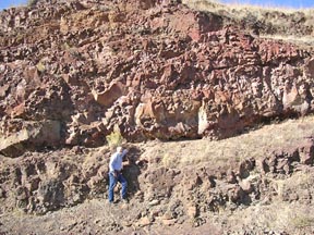
Geologic Evolution and HazardsBecause the lavas were typically sheet flows, they provide an ideal regional time horizon to understand paleoenvironments, paleodrainage systems during eruptions, and evolution of fault and fold structures. Location of faults, and timing and direction of fault movement can be inferred by compiling and analyzing the stratigraphy of the CRBG. The pattern of folding and faulting in the CRBG is consistent with contemporary deformation measured by GPS and provides an integrated picture of geologic strain in populated areas. This information is currently being used to map geologic structures that may pose hazards to people and infrastructure in the Groundwater Resources
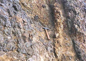
Although permeable interflow zones may yield large amounts of water initially, continued large withdrawals result in declines in water levels because of low storage properties and limited recharge of water reaching these productive zones. In order to understand and manage this important, but limited, groundwater resource, CRBG stratigraphy is used to identify interflow zones and map their lateral continuity. Once the interflow zones are mapped, the permeability and hydraulic connection of interflow zones can be determined and informed management options considered. The USGS and others use this information to improve the understanding of groundwater flow in the CRBG and provide information to agencies responsible for managing the water resources in the CRBG. See: Willamette Basin Groundwater Study |
||
|
|
|
Oregon Water Science Center Studies Page Oregon Water Science Center Home Page |
![]() U.S. Department of the Interior |
U.S. Geological Survey
U.S. Department of the Interior |
U.S. Geological Survey
URL: https://or.water.usgs.gov/proj/crbg/importance.html
Page Contact Information: Oregon Webteam
Page Last Modified: Wednesday, 08-Mar-2017 20:07:14 EST