Mosier Valley Ground-Water Sustainability Study |
In Cooperation with the Wasco County Soil and Water Conservation District |
| Skip site navigation bar and go to main content
Contact: |
 The Mosier Creek Basin is located in the eastern foothills of the Cascade Range in northwestern Wasco County, Oregon. The drainage area of the principal streams, Mosier, Rock, and Rowena Creeks, is nearly 80 square miles. Pumping for irrigation, primarily since the 1960s, has resulted in significant water level declines in the lower basin--as much as 120 feet in some wells--making it necessary for many well owners to deepen their wells or construct new ones. Lowered water levels also increase irrigation costs because of the additional energy required to pump water from greater depths. Further, water-level declines have decreased ground-water discharge to Mosier Creek, which provides passage and rearing habitat for threatened salmonid populations. The Mosier Creek Basin is located in the eastern foothills of the Cascade Range in northwestern Wasco County, Oregon. The drainage area of the principal streams, Mosier, Rock, and Rowena Creeks, is nearly 80 square miles. Pumping for irrigation, primarily since the 1960s, has resulted in significant water level declines in the lower basin--as much as 120 feet in some wells--making it necessary for many well owners to deepen their wells or construct new ones. Lowered water levels also increase irrigation costs because of the additional energy required to pump water from greater depths. Further, water-level declines have decreased ground-water discharge to Mosier Creek, which provides passage and rearing habitat for threatened salmonid populations.
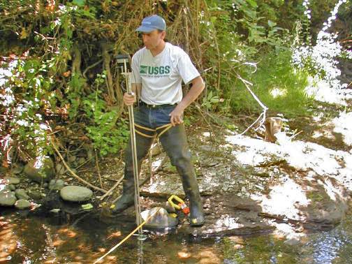
In 2005 the Oregon Water Science Center of the U.S. Geological Survey entered into a cooperative agreement with the Wasco County Soil and Water Conservation District and the Mosier Watershed Council to investigate the hydrology of the basin and use the knowledge gained to develop a set of tools that can be used to evaluate the sustainable yield of the ground-water resource. Another objective of this project was to advance the understanding of Columbia River Basalt aquifers. These aquifers constitute some of the most productive aquifers in Oregon, Washington, and Idaho, and they have been heavily developed for agricultural, municipal, and domestic water supplies, often with the same result as in the Mosier Creek Valley. The techniques developed during this study will be widely applicable in similar studies of Columbia River Basalt aquifers.Go back to site navigation barGo to external links |
|
|
|
| Oregon Water Science Center Studies Page Oregon Water Science Center Home Page |
|