Water Quality in Willow Creek Reservoir near Heppner, OR
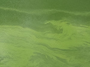
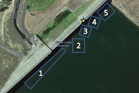
The U.S. Geological Survey (USGS), in collaboration with the U.S. Army Corps of Engineers (USACE), monitored water quality at Willow Creek Reservoir in 2015 and 2016 using a variety of techniques, including the use of cameras and multiparameter water-quality instruments to collect data. The goals of the monitoring are to study and understand the dynamics of the blue-green algae blooms in this water body, and to provide data and information that allows the public and resource managers to be informed about water-quality and bloom conditions in the reservoir. Data collected in 2015 showed that the algal blooms can accumulate and dissipate very quickly. A camera was deployed at Willow Creek Dam in 2015 and 2016, and it collected a series of five images (positions 1-5) of the lake surface near the dam every 15 minutes during daylight hours. The images were uploaded to this public website in near real-time, allowing interested people to view the current reservoir conditions. The locations of the camera and the five camera image positions are shown in the map below. The location of the camera on the dam is indicated by the five-pointed star, and the numbered rectangles indicate the locations of the images taken by the camera. Position number 1 is photographed first, followed by position number 2, and so forth.
Access the 2016 photographs here.
|
![]() U.S. Department of the Interior |
U.S. Geological Survey
U.S. Department of the Interior |
U.S. Geological Survey
URL: https://or.water.usgs.gov/willow_creek_res/index.html
Page Last Modified: Tuesday - Feb 28, 2017 at 13:09:33 EST