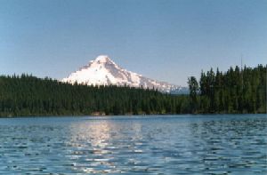
 View of Mt. Hood from Timothy Lake, source of the Clackamas River (Photo by K. Carpenter) |
![]() U.S. Department of the Interior |
U.S. Geological Survey
U.S. Department of the Interior |
U.S. Geological Survey
URL: https://or.water.usgs.gov/proj/or176/or176.html
Page Contact Information: Kurt Carpenter
Page Last Modified: Thursday - May 16, 2024 at 11:05:03 EDT
