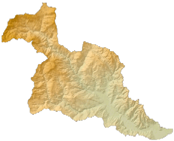
 Shaded relief map of Scoggins Creek drainage |
Available digital elevation models (DEMs) from USGS typically do not include the land surface topography (bathymetry) beneath the water surface of lakes and reservoirs. The Bureau of Reclamation (BOR) conducted a bathymetric survey of Henry Hagg Lake in 2001 and created a hypsography coverage from those bathymetric data. USGS personnel used Geographic Information Systems (GIS) to integrate the BOR bathymetric dataset with a USGS DEM of the topography above the lake's water surface. Using this newly combined surface dataset, a USGS water-quality model of Henry Hagg Lake was constructed to evaluate both current water quality and future scenarios in which the lake might be expanded.
The original USGS DEM was converted to a hypsography layer (contour line coverage). The hypsography and bathymetry layers were then joined. Manual editing was required to remove discrepancies between the edges of the datasets. Finally, the new contour coverage was formed into a new surface DEM. The DEM boundaries were clipped to the Scoggins Creek drainage, which was delineated using ESRI ArcGIS ArcHydroTools. The topographic and bathymetric surface data in this new dataset are seamless.
The resulting GIS package is available for download as a ZIP file [1.81 Mb]. The package contains a README file, metadata text, a JPEG image of the surface grid, the surface grid saved as a .DEM file, and the original surface grid in ESRI ArcINFO grid format. The dataset represents all surface elevations in feet above sea level. Metadata are included in both text format and embedded as XML within the raster. Data processing steps and grid information are contained in the metadata. The grid cell resolution is 20 meters. The dataset's projection is UTM Zone 10, NAD83. The vertical datum is NGVD29.
Questions about the specifics of this merged GIS dataset should be directed to:
Steven Sobieszczyk
U.S. Geological Survey
2130 SW 5th Avenue
Portland, OR 97201
(503) 251-3208
ssobie@usgs.gov
Questions about the Bureau of Reclamation's bathymetric survey of Henry Hagg Lake should be directed to:
Ronald L. Ferrari
Sedimentation and River Hydraulics Group
Water Resources Services, Technical Service Center
Bureau of Reclamation
Denver Federal Center
P.O. Box 25007
Denver, CO 80225-0007
(303) 445-2551
rferrari@do.usbr.gov
For more information about this project, contact:
Stewart Rounds
U.S. Geological Survey
2130 SW 5th Avenue
Portland, OR 97201
503-251-3280
sarounds@usgs.gov
Oregon Water Science Center Home
page
Oregon Water Science Center
Hydrologic Studies page
Tualatin Water Quality Assessment page
Hagg Lake Water Quality Model page
Hagg Lake Model Scenarios page
![]() U.S. Department of the Interior |
U.S. Geological Survey
U.S. Department of the Interior |
U.S. Geological Survey
URL: https://or.water.usgs.gov/tualatin/hagg_lake/hagg_lake_dem.html
Page Contact Information: Stewart Rounds
Page Last Modified: Sunday - Jan 13, 2013 at 20:22:54 EST
