USGS: Science for a Changing World 

HYDROGRAPHS FOR OBSERVATION WELLS IN THE LA PINE BASIN, OREGON


Click below on a well to view a hydrograph of water-level measurements
Use the below list to distinguish between wells located near each other that may plot as one well

Well hydrographs and ascii data tables

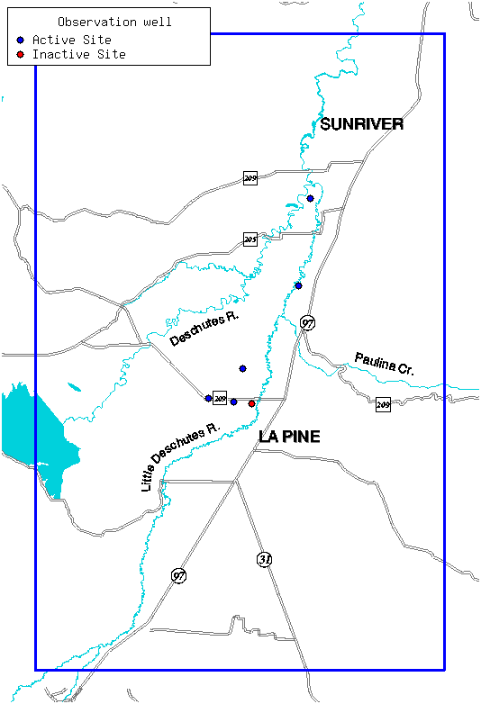
    WELL LOG-ID    NWIS SITE ID		   FILE FORMATS          STATUS

    DESC 52676  ( 434202121301503)    PNG    JPG    GIF     TXT    inactive
    DESC 52677  ( 434202121301502)    PNG    JPG    GIF     TXT    inactive
    DESC 52678  ( 434202121301501)    PNG    JPG    GIF     TXT    active
    DESC 52684  ( 434206121311701)    PNG    JPG    GIF     TXT    active
    DESC 52690  ( 434213121324101)    PNG    JPG    GIF     TXT    active
    DESC 53158  ( 435035121270802)    PNG    JPG    GIF     TXT    active
    DESC 53164  ( 435035121270801)    PNG    JPG    GIF     TXT    active
    DESC 53656  ( 434328121304603)    PNG    JPG    GIF     TXT    active
    DESC 53660  ( 434657121274101)    PNG    JPG    GIF     TXT    active


La Pine Ground-Water Data Page
La Pine Project Page
Oregon District Home Page

http://oregon.usgs.gov/projs_dir/or186/waterlevels/recorders/index.html
http://oregon.usgs.gov/projs_dir/or175/waterlevels/recorders/lapine.html
Last modified: 1/7/2002