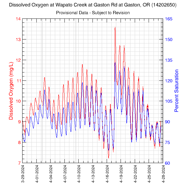
30-Days of Dissolved Oxygen in the Wapato Creek at Gaston Rd (14202650)Data are downloaded and processed multiple times each day. The Wapato Creek at Gaston Road site is located just downstream of the Wapato Lake pumphouse. Data are collected every 30 minutes. Periods with no data are plotted as grey areas. Data in the graph are plotted against the axis of the same color. Percent saturation is estimated as a function of water temperature and barometric pressure at the Oswego Dam site. These data are provisional and are subject to revision. Graph updated: Friday - Jul 3, 2026 at 23:00:28 EDT
|
![]() U.S. Department of the Interior |
U.S. Geological Survey
U.S. Department of the Interior |
U.S. Geological Survey
URL: https://or.water.usgs.gov/tualatin/monitors/wapato_dosat_30.html
Page Contact Information: Erin Leahy
Page Last Modified: Wednesday - Apr 2, 2025 at 14:41:41 EDT