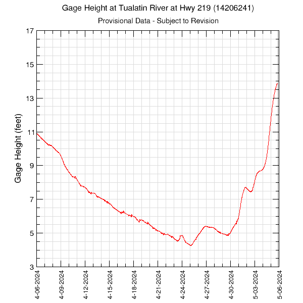
30-Days of Gage Height in the Tualatin River at Highway 219 (14206241)Data are downloaded and processed nearly every hour. The Tualatin River at Highway 219 site is located at river mile 44.4. Data are collected every 15 minutes. Periods with no data are plotted as grey areas. These data are provisional and are subject to revision. Graph updated: Saturday - Jul 4, 2026 at 05:00:08 EDT
|
![]() U.S. Department of the Interior |
U.S. Geological Survey
U.S. Department of the Interior |
U.S. Geological Survey
URL: https://or.water.usgs.gov/tualatin/monitors/hwy219_gh_30.html
Page Contact Information: Erin Leahy
Page Last Modified: Wednesday - Apr 2, 2025 at 14:40:40 EDT