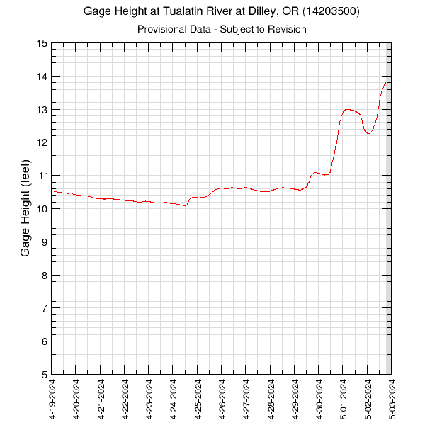
14-Days of Gage Height in the Tualatin River at Dilley (14203500)Data are downloaded and processed every 2 hours. The Tualatin River at Dilley site is located at river mile 58.8 at Springhill Road. Data are collected every 15 minutes. Periods with no data are plotted as grey areas. These data are provisional and are subject to revision. To obtain water-surface elevation, add 151.05 feet to the gage height to get an elevation relative to the North American Vertical Datum of 1988 (NAVD88). Add 147.57 feet to the gage height at this location to get an elevation relative to National Geodetic Vertical Datum of 1929 (NGVD29). Graph updated: Saturday - Jul 4, 2026 at 03:59:12 EDT
|
![]() U.S. Department of the Interior |
U.S. Geological Survey
U.S. Department of the Interior |
U.S. Geological Survey
URL: https://or.water.usgs.gov/tualatin/monitors/dilley_gh_14.html
Page Contact Information: Erin Leahy
Page Last Modified: Wednesday - Apr 2, 2025 at 14:39:46 EDT