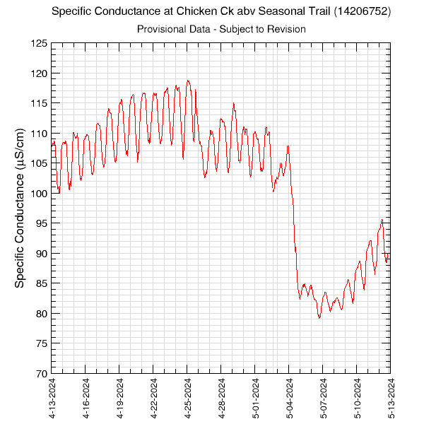
30-Days of Specific Conductance in Chicken Creek above Seasonal Trail (14206752)Data are downloaded multiple times per day. The U.S. Geological Survey collects continuous water-quality data from Chicken Creek just upstream of the seaonal trail in the Tualatin River National Wildlife Refuge, which also is just upstream of where Chicken Creek joins the Tualatin River. Water-quality data are collected every 30 minutes. Periods with no data are plotted as grey areas. These data are provisional and are subject to revision. Graph updated: Saturday - Jul 4, 2026 at 04:59:41 EDT
|
![]() U.S. Department of the Interior |
U.S. Geological Survey
U.S. Department of the Interior |
U.S. Geological Survey
URL: https://or.water.usgs.gov/tualatin/monitors/chicken_trail_cond_30.html
Page Contact Information: Erin Leahy
Page Last Modified: Wednesday - Apr 2, 2025 at 14:39:22 EDT