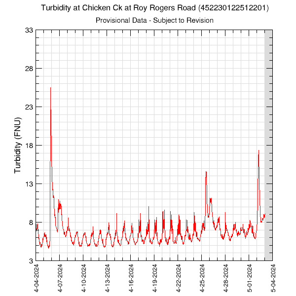
30-Days of Turbidity in Chicken Creek at Roy Rogers Road (452230122512201)Data are downloaded multiple times per day. This monitor is located in Chicken Creek at Roy Rogers Road. Data are collected on the half-hour. Periods with no data are plotted as grey areas. These data are provisional and are subject to revision. Turbidity data are measured in FNU units. Graph updated: Wednesday - Jun 24, 2026 at 11:59:11 EDT
|
![]() U.S. Department of the Interior |
U.S. Geological Survey
U.S. Department of the Interior |
U.S. Geological Survey
URL: https://or.water.usgs.gov/tualatin/monitors/chicken_tbdy_30.html
Page Contact Information: Erin Leahy
Page Last Modified: Wednesday - Apr 2, 2025 at 14:39:20 EDT