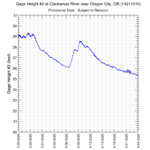
These are auxiliary gage height data. The primary gage height data can be found here.
Data at this site are collected every 30 minutes. Periods with no data are plotted as grey areas. All data presented here are provisional and are subject to revision.
Graph updated: Sunday - Jun 28, 2026 at 09:29:20 EDT
![]() U.S. Department of the Interior |
U.S. Geological Survey
U.S. Department of the Interior |
U.S. Geological Survey
URL: https://or.water.usgs.gov/proj/or176/monitors/oregon_city_gh2_30.html
Page Contact Information: Abigail Tomasek
Page Last Modified: Friday - Apr 4, 2025 at 13:58:45 EDT
