
|
Yakima NAWQA
Links
Related
Links
If you have questions or comments about the Yakima NAWQA study, contact:
Greg Fuhrer |
The Yakima River BasinThe Yakima River flows 215 miles from the outlet of Keechelus Lake in the central Washington Cascades southeasterly to the Columbia River, draining an area of 6,155 square miles. The Yakima River Basin is one of the most intensively irrigated areas in the United States. The main stem and its largest tributary, the Naches River, are perennial, with peak runoff during peak snowmelt, usually in April and May. 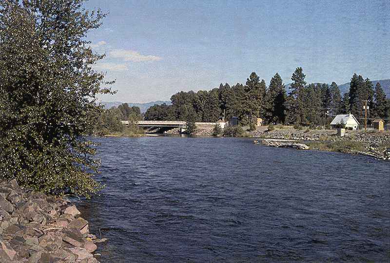 Yakima River near Cle Elum The Yakima River Basin contains a variety of landforms, including the high peaks and deep valleys of the Cascade Range, broad valleys and basalt ridges of the Columbia Plateau, and lowlands. Altitude in the basin ranges from 340 ft at the mouth of the Yakima River to 8,184 ft near the headwaters, which arise in the Cascade Range to the west and north. Glaciation has carved deep valleys in the high mountains, and streams and small glaciers continue to erode the already steep slopes. Mean annual precipitation in the basin ranges from 140 inches per year in the mountains to less than 10 inches per year in Kennewick, near the mouth of the basin. The central and eastern parts of the basin consist of basalt flows that form a series of east-northeast to east-southeast trending valleys and ridges. The eastern part is more arid than the western part, which is forested and mountainous. Major land use activities in the Yakima River Basin include growing and harvesting timber, grazing on nonirrigated land, intensively irrigated agriculture, and urbanization. Intense water use for agriculture and cities makes these land use categories of primary importance to water-quality issues. Population in the Yakima River Basin was about 238,000 in 1990. 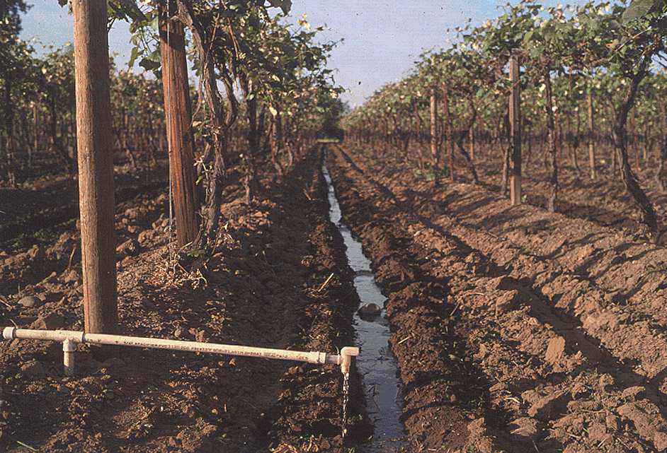 The forested northern and western areas in the Yakima River Basin lie in the Wenatchee and Snoqualmie National Forests, on the eastern slope of the Cascade Range. These forestlands are used for recreation, wildlife habitat, grazing, and timber harvesting. About one-fourth of this area is wilderness land, which has been designated for nonmotorized recreation. Rangelands are used for cattle grazing, wildlife habitat, and military training (at the Yakima Firing Center, northeast of the city of Yakima). The Bureau of Reclamation's Yakima Project has seven irrigation divisions and provides water to irrigate almost one-half million acres. Its facilities include 6 storage reservoirs, 416 miles of canals, 1,701 miles of laterals, 30 pumping plants, 145 miles of drains, 2 small hydroelectric plants, and 74 miles of transmission lines. Many of these waterways, most of which are natural streams, convey agricultural runoff and drainage, livestock wastes, and sewage treatment plant effluent to the main stem. Surface water diversions are equivalent to about 60 percent of the mean annual streamflow from the basin. Return flows downstream from the city of Yakima contribute as much as 80 to 90 percent of the flow in the lower main stem during the irrigation season. Many of these inflows carry agricultural return flow. Before 1880, annual anadromous fish runs numbered more than 500,000 adults in the Yakima River Basin. By 1905, however, construction of irrigation projects, including reservoirs, as well as pre-1900 fish wheel and cannery activities, had affected fish habitat and migrations. By the 1980s, anadromous fish runs had declined to 4,000 adults per year (Bonneville Power Administration, 1988). The major factors considered to affect fisheries in the basin today are loss of fish habitat, loss of smolts during migration down the Yakima and Columbia Rivers to the ocean, fishing demands on the Columbia River and in the ocean, and poor water-quality conditions in the basin. |