Oregon Water Science Center
Water Temperature Modeling in the Middle Fork Willamette and South Santiam River Basins to Assess the Effects of Dams and Dam OperationsContact: Norman L. Buccola or Stewart A. Rounds Cooperator: U.S. Army Corps of Engineers BACKGROUND
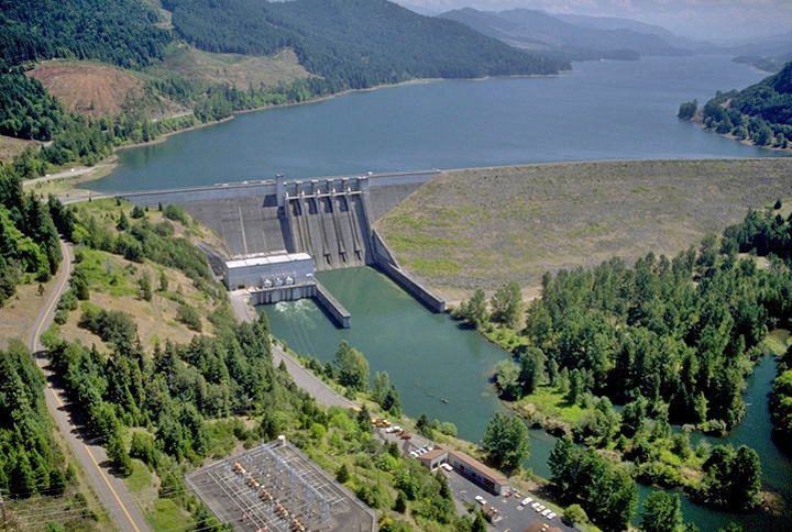
Hills Creek, Lookout Point and Dexter Dams are located on the Middle Fork Willamette River upstream of Eugene in western Oregon, and are important resources managed by the U.S. Army Corps of Engineers (USACE) for flood damage protection, hydroelectric power, recreation, navigation, and irrigation. Hills Creek and Lookout Point Dams impound large reservoirs (234,300 and 336,400 acre-feet of usable storage, respectively), whereas Dexter Dam is smaller and serves primarily as a re-regulating dam for releases from Lookout Point Dam. On the South Santiam River east of Albany in western Oregon, Green Peter and Foster Dams provide functions and resources that are similar to those of the Middle Fork Willamette River dams. Green Peter Lake has 312,500 acre-feet of usable storage and is much larger and deeper than Foster Lake, a downstream re-regulating project that holds 28,300 acre-feet at full pool. The dams on both of these river systems are under scrutiny because the Reasonable and Prudent Alternatives listed in the 2008 Willamette Basin Biological Opinion (National Marine Fisheries Service, 2008) requires USACE to assess the feasibility of developing project-specific alternatives for achieving fish passage as well as improved long-term temperature control downstream of these dams. The goal of improved temperature management is to provide suitable water temperatures for endangered Upper Willamette River (UWR) Chinook salmon (Oncorhynchus tshawytscha) and UWR winter steelhead (O. mykiss). USACE must prepare an Alternatives Report addressing these issues. To support that effort, USACE asked the USGS Oregon Water Science Center (ORWSC) to model water flow and temperature through the Hills Creek/Lookout Point/Dexter dam complex on the Middle Fork Willamette River and the Green Peter/Foster dam complex on the South Santiam River system to assess the effects of potential structural and operational changes at the dams. To help USACE determine the ways in which structural and/or operational changes to dams on the Middle Fork Willamette and South Santiam River systems can improve downstream water temperature and flow conditions for endangered fish species, the USGS is using existing models to simulate the effects of structural and operational scenarios and follow the effects downstream. On the Middle Fork Willamette River, results from the Hills Creek model feed into the Lookout Point/Dexter model. For the South Santiam River, results from the Foster model feed into a South Santiam River model. ObjectivesThe objectives of this investigation are to:
ApproachAll objectives will be completed by using existing CE-QUAL-W2 models originally developed by West Consultants, Inc., for the Lookout Point/Dexter system (West Consultants, Inc., 2004a), Hills Creek Lake (West Consultants, Inc., 2004b), Foster Lake (West Consultants, Inc., 2005), and the South Santiam River (model developed by Oregon Department of Environmental Quality and Portland State University for a temperature Total Maximum Daily Load).
DownloadsMiddle Fork WillametteCalibrated models for 2002 [zip 4.2MB], 2006 [zip 5.7MB], 2008 [zip 4.1MB], 2011 [zip 5.4MB] Animations: 2011 South SantiamCalibrated models for 2002 [zip 2.4MB], 2006 [zip 4.0MB], 2008 [zip 4.0MB], 2011 [zip 4.5MB] Selected ReferencesBuccola, N.L., Stonewall, A.J., Sullivan, A.B., Kim, Yoonhee, and Rounds, S.A., 2013, Development of CE-QUAL-W2 models for the Middle Fork Willamette and South Santiam Rivers, Oregon: U.S. Geological Survey Open-File Report 2013–1196, 55 p. (Also available at http://pubs.usgs.gov/of/2013/1186/.) Buccola, N.L, Rounds, S.A., Sullivan, A.B., and Risley, J.C., 2012, Simulating potential structural and operational changes for Detroit Dam on the North Santiam River, Oregon, for downstream temperature management: U.S. Geological Survey Scientific Investigations Report 2012–5231, 68 p. (Also available at http://pubs.usgs.gov/sir/2012/5231/.)
Buccola, N.L., and Rounds, S.A., 2011, Simulating potential structural and operational changes for Detroit Dam on the North Santiam River, Oregon—Interim Results: U.S. Geological Survey Open-File Report 2011–1268, 32 p. (Also available at http://pubs.usgs.gov/of/2011/1268/.) Cole, T.M., and Wells, S.A., 2010, CE-QUAL-W2—A two-dimensional, laterally averaged, hydrodynamic and water-quality model, version 3.7: U.S. Army Corps of Engineers, Instruction Report EL-08-1, [variously paged]. Rounds, S.A., 2010, Thermal effects of dams in the Willamette River Basin, Oregon: U.S. Geological Survey Sullivan, A.B. and Rounds, S.A., 2004, Modeling streamflow and water temperature in the North Santiam and Sullivan, A.B., Rounds, S.A., Sobieszczyk, Steven, and Bragg, H.M., 2007, Modeling hydrodynamics, water West Consultants, Inc., 2004a, Development of a CE-QUAL-W2 model for Lookout/Dexter Reservoirs: Seattle, WA, prepared for U.S. Army Corps of Engineers under contract DACW57-02-D-0005, 40 p. West Consultants, Inc., 2004b, Development of a CE-QUAL-W2 model for Hills Creek Reservoir: Seattle, WA, prepared for U.S. Army Corps of Engineers under contract DACW57-02-D-0005, 42 p. West Consultants, Inc., 2005, Development of a CE-QUAL-W2 model for Green Peter and Foster Reservoirs: Seattle, WA, prepared for U.S. Army Corps of Engineers under contract DACW57-02-D-0005, 43 p. |
![]() U.S. Department of the Interior |
U.S. Geological Survey
U.S. Department of the Interior |
U.S. Geological Survey
URL: https://or.water.usgs.gov/proj/mfw_ssr_temp/index.html
Page Contact Information: Oregon Webteam
Page Last Modified: Tuesday, 20-Dec-2016 17:08:05 EST