Oregon Water Science Center
Summary and Significant Findings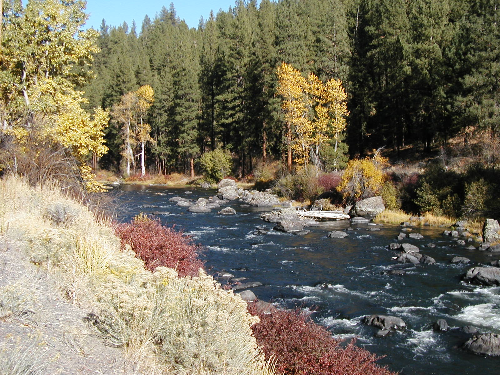
Sprague River in fall. The Sprague River basin encompasses 4,167 square kilometers (km2) of south-central Oregon and is a principal tributary (via the lower Williamson River) of Upper Klamath Lake. The main-stem Sprague River, as well as the lower reaches of the North Fork Sprague River, South Fork Sprague River, and the Sycan River, meander through broad alluvial valleys historically supporting agriculture and livestock grazing. National and regional interest in restoring Klamath Basin ecosystem conditions and processes has motivated several restoration strategies and projects in the Sprague River basin to improve aquatic, riparian, and upland habitat conditions. The study described herein, jointly conducted by the U.S. Geological Survey (USGS) and University of Oregon and in cooperation with the U.S. Fish and Wildlife Service Klamath Basin Ecosystem Restoration Office and the Hatfield Restoration Program, provides basic information on channel and flood-plain processes and historical trends to help management and regulatory agencies evaluate restoration proposals and guide effective restoration and monitoring strategies for the Sprague River and its principal tributaries. The study area (figure 1, plate) comprised the lower, alluvial segments of the Sprague River system, including the lower portions of the Sycan River, North Fork Sprague River, South Fork Sprague River, and the entire main-stem Sprague River between the confluence of the North and South Forks and its confluence with the Williamson River at Chiloquin, Oregon. Our analyses employed multiple methods encompassing wide spatial and temporal scales, relying on mapping and stratigraphic analysis of flood-plain deposits and flanking features, evaluation of historical records and observations, systematic mapping and analysis of flood-plain and channel characteristics (including morphologic and vegetation conditions) from historical surveys, maps, and aerial photographs, and a 2006 survey of depositional features left by early 2006 high flows. Analyses primarily focused on the channel and flood plain within an area defined as the geomorphic flood plain. The geomorphic flood plain, in total encompassing 78 km2, is the low-lying and relatively flat area flanking the main channels that has been significantly affected by main-stem fluvial processes of erosion, deposition, channel migration, and flood inundation during the Holocene epoch. The geomorphic flood plain was subdivided into 13 valley segments of distinct fluvial and biologic environments on the basis of valley form and major tributary junctions: nine segments that encompass the 136.1 km of main-stem Sprague River, two segments for the lower Sycan River, and one segment for each portion of the South Fork Sprague and North Fork Sprague Rivers within the study area. Segment characteristics range from low gradient reaches with expansive flood plains to steep and narrow canyons. The wide flood-plain valley segments are broadly similar; most contain a sinuous, low-gradient channel that migrates slowly across the valley bottom. The narrow valley segments include the steep, boulder-and-cobble-bed reaches at downstream and upstream ends of the study area as well as other confined valley segments that have similar gradients and substrates as adjacent unconfined valley segments, but much lower sinuosities. Although the geologic setting of the expansive South Fork valley segment resulted in historical conditions of sinuous and poorly defined channels and wet meadows, flanking levees now narrowly confine the channelized South Fork Sprague River for much of its length. The fine-grained extrusive volcanic rocks and lacustrine sediment that compose most of the Sprague River basin do not produce much sand and gravel bed material. In the absence of substantial bed material prior to the Mazama eruption of 7,700 calendar years before present (cal yr BP), the main rivers of the study area were apparently flanked by wetlands and low flood plains, and migration rates were probably very low. The eruption, however, covered much of the northern watershed with sand- and granule-size pumice clasts, transforming the fluvial system by increasing bed-material transport and promoting bar formation and channel migration, particularly for the Sycan and North Fork Sprague Rivers, and the Sprague River downstream of the Sycan River confluence. The South Fork Sprague River, which had much less Mazama pumice deposited in its watershed, remained a wet-meadow fluvial system until historical channelization and diking. Despite the pumiceous sand input and the general low gradients of the main channels within the study area, the present overall bed-material sediment regime is supply limited, meaning the transport capacity exceeds the supply of bed material. This is locally manifested by the discontinuous alluvial cover of the channel bottom, the sparse bars in and flanking the channel, and the overall slow channel migration rates compared to many western North American rivers. Although channel migration rates are low, lateral channel movement is an important process for maintaining channel and flood-plain materials, form, and function. Lateral migration forms and expands meanders, increasing sinuosity. Meander enlargement is countered by avulsions and meander cutoffs, including chute and neck cutoffs, which reduce sinuosity. The decrease in sinuosity since 1940 for nearly all the unconfined reaches is in part due to decreased migration rates, but owes chiefly to several cutoffs and avulsions formed mainly between 1940 and 1975. The frequency of avulsions and meander cutoffs may have been enhanced by (1) flood-plain confinement by levees, dikes, roads, and railroads leading to deeper and faster overbank flow thereby promoting erosion of new flood-plain channels and (2) flood-plain disturbances such as trails, ditches, and vegetation manipulation or eradication that locally concentrated overbank flow and decreased surface resistance to channel erosion. The Sprague Rivers channel is generally not incised (lowered) to the extent that floods fail to inundate the flood plain. The floods of 2006 left overbank deposits over flood-plain surfaces along the entirety of the main-stem Sprague, lower Sycan, and lower North Fork Sprague Rivers, consistent with the stratigraphic evidence of substantial flood-plain deposition and construction over the last several hundred years. By contrast, up to 1.6 m of historical incision is evident in the upstream part of the study area, chiefly in the South Fork valley but possibly extending several kilometers downstream from the North Fork and South Fork confluence. A general absence of channel incision for much of the study area is consistent with little evidence of channel widening. Neither analyses using General Land Office (GLO) surveys nor those of historical aerial photographs indicate overall widening or narrowing trends in channel width, although individual valley segments have had channels narrow or widen. The Sycan River is unique because of the profound influence of the 7,700 cal yr BP Mazama eruption on its catchment. The Sycan flood, shortly after the eruption, formed a broad deposit of loose and coarse pumiceous sand, now incised by the channel and younger flood plains. Episodes of watershed-scale enhanced sediment supply subsequent to the flood resulted in construction of sandy flood plains flanking the channel, which continue to be susceptible to lateral erosion. As a consequence, the Lower Sycan valley segment has abundant bars, wide channels, and high migration rates relative to other valley segments. The South Fork Sprague River was little affected by the Mazama eruption; consequently, the historical condition of its fluvial systems was probably markedly different from that of the Sycan River and, to a lesser extent, the North Fork Sprague River. At the time of the GLO surveys in the 1860s and for thousands of years prior, the South Fork Sprague River was probably a poorly defined and stable (and locally multithreaded) channel and wet-meadow complex fringed by willows, seasonally flooding and slowly aggrading (elevating) the expansive valley bottom by depositing sediment. Beavers may have had a role in controlling local flood-plain and channel conditions. Human actions, however, have locally affected Sprague River channel and flood-plain conditions since first European settlement in the 1860s. Most evident are the contemporaneous and persistent effects of channelization and flood-plain confinement by levees, roads, and the former OC&E railroad alignment, mainly dating from the 1920s through the 1970s. Channelization before 1940 transformed the South Fork Sprague River into an incised channel of low sinuosity. Less evident are the effects of levees, but flood-plain confinement has probably increased the frequency of avulsions and cutoffs, resulting in reduced sinuosity and overall greater channel slopes since 1940. Riparian grazing and channel and bank trampling by cattle have locally affected bank and channel conditions, as has local accumulations of dumped rock at fords and former bridge crossings. Channel remeandering, chiefly since 2000, has locally resulted in filling of chute cutoffs and avulsions and placing the primary channel back into historical positions. The South Fork Sprague River has been the most clearly transformed since first historical observations. The present channel is incised, straightened, and separated from the flood plain by levees for much of its alluvial corridor. Significant portions of the flood plain have been drained and leveled. Multiple in-channel structures currently divert flow into irrigation channel networks. This valley segment also appears to be a major source of suspended sediment to the Sprague River fluvial system. Despite these broadscale and local effects of human disturbances, many of the fundamental physical processes that have shaped the Sprague River fluvial systems over the last several thousand years still function to various degrees. Most importantly, the overall bed-material transport regime, including sediment supply and water flow, which drives processes of bar building and channel migration, has not been substantially affected by upstream impoundments interrupting either flow or sediment. Also important is the absence of systemwide channel incision, which can limit restoration opportunities. Areas of the fluvial system that have been incised, particularly the South Fork valley segment, are in the upstream part of the study area, limiting the likelihood that geomorphic effects (aside from changes in flow and sediment transport) will migrate to other parts of the study area. These factors suggest that restoration of many of the native physical conditions and processes is possible for much of the Sprague River study area without substantial physical manipulation of current conditions. General spatial patterns of vegetation in the Sprague River flood plain are influenced by broadscale basin characteristics. Tall woody species prefer narrow, confined, and shaded flood plains. Wide flood plains are mostly covered with herbaceous plants, but past and present channel areas are locally flanked by short woody vegetation. These predominant attributes have remained constant since the first historical observations in the 1800s, chiefly because the areas within the study area have remained generally pastoral, without substantial urbanization, timber harvest (within the flood plain) or basin-scale changes in flow and sediment regimes. At finer scales, however, near-channel areas are more dynamic than the flood plain as a whole, reflecting the important roles of fluvial disturbance and succession in creating riparian vegetation communities, and perhaps exacerbated by predation and concentrated grazing. Some individual cover types, however, show clear trends, despite the general stability of overall vegetation patterns. The most evident change has been the loss of short woody vegetationonly half the near-channel area covered by short woody vegetation in 1940 was similarly covered in 2000. The loss of short woody vegetation to less complex early seral (successional) stages was the chief change among many indicating vegetation disturbance and loss of structural complexity, particularly before 1968. Since 1968, changes have been of smaller magnitude and more evenly distributed between advancing and declining seral stages. Vegetation changes have resulted from a combination of geomorphic processes and trends, vegetation succession, direct vegetation manipulation, and broadscale land use. Transitions among the bare and water cover types are chiefly the result of decreased sinuosity and large floods. Woody vegetation removal in the 1950s and 1960s in conjunction with continuing grazing and trampling by livestock are probably the main reasons for the decline of short woody vegetation from the dense riparian corridors of willows and other riparian shrubs noted in the early 20th century. Since 1968, vegetation succession has locally increased seral stage and habitat complexity, partly balancing the effects of earlier disturbance processes. The findings regarding physical processes, historical conditions, and vegetation patterns and changes have implications for restoration and monitoring of the Sprague River basin. Most importantly, many physical processes and conditions driving channel and flood-plain formation have not been substantially altered at the basin scale. This contrasts with many western rivers, in which dams and diversions have substantially affected sediment and water fluxes, and where channel incision has limited interaction between channels and flood plains. Because overall basin conditions have not been markedly altered in the Sprague River basin, historical conditions provide a plausible reference frame for restoration objectives. For the broad area of the Sprague River study area in which flood flows regularly inundate the flood plain, natural processes may be sufficient under proper conditions to reverse historical trends of decreasing sinuosity and loss of short woody vegetation cover. But, for the alluvial section of the South Fork Sprague River, historical and ongoing channel incision and flood-plain erosion will inhibit reversal of historical trends and will likely continue to be a source of suspended sediment load to the river system. For this reach, incision will likely continue as long as the channel is fully constrained by levees and dikes and until knick zones progress to locations where channel substrate resists continued down-cutting. While changes may slow in the South Fork valley segment under present conditions, historical trends are not likely to reverse until a more natural channel and flood-plain geometry is attained and the channel aggrades to the extent that overbank flow becomes common. For most of the Sprague River flood plain, the greatest likelihood of restoration to pre-development conditions would result from a strategy emphasizing natural processes for the entire geomorphic flood plain. A less conservative strategy could reverse historical changes by focusing on a narrower region about the channel, where processes are most dynamic and the coupling between channel and flood-plain is strongest. Such a strategy, however, carries some risk, because avulsions and cutoffs, which create ecologically important flood-plain features, extend to areas beyond the near-channel environment. An important aspect of the Sprague River study area relative to restoration is that geomorphic processes are slow. The low slopes, low bed-material supply and transport rates, and low stream powers all result in naturally slow rates of channel and flood-plain evolution. In particular, rates of channel migration, meander enlargement (increasing sinuosity), lateral and vertical flood-plain building, and short woody vegetation recovery are likely to require decades or longer under passive management scenarios. Consequently, restoration objectives dependent on natural processes may take more time to achieve than for more energetic and sediment-rich fluvial systems more typical in western North America. The findings from this study indicate that the following activities can facilitate natural geomorphic and vegetation processes important to ecological conditions in the Sprague River basin:
The outcomes of these activities could be monitored by some of the methods used in this study. Repeat mapping of channel and flood-plain conditions from new aerial photographs, using the protocols employed by this study, would allow for direct comparison and measurements of plan-view channel morphology, channel migration rates, and vegetation conditions. Additionally, monitoring of the effects of significant flows, such as conducted in the analysis of the 2006 high flows, would enable continued assessment of the efficacy of key channel and flood-plain processes during geomorphically effective events. Such broadscale monitoring is not likely to discern immediate effects of site-specific restoration activities, but should be able to document trends resulting from the cumulative effects of activities at the scale of valley segments or the entire study area. Suggested citation:O’Connor, J.E. McDowell, P.F., Lind, Pollyanna, Rasmussen, C.G., and Keith, M.K., 2013, Geomorphology and flood-plain vegetation of the Sprague and lower Sycan Rivers, Klamath Basin, Oregon: U.S. Geological Survey Webpage, http://or.water.usgs.gov/proj/Sprague/report/index.html, doi:10.5066/F7BG2M0R |
Contents:
For more information, contact: Director, Oregon Water Science CenterU.S Geological Survey 2130 SW 5th Ave Portland, OR 97201 Phone: (503) 251-3200 E-mail: info-or@usgs.gov Part or all of this report is presented in Portable Document Format (PDF); the latest version of Adobe Reader or similar software is required to view it. Download the latest version of Adobe Reader, free of charge. |
![]() U.S. Department of the Interior |
U.S. Geological Survey
U.S. Department of the Interior |
U.S. Geological Survey
URL: https://or.water.usgs.gov/proj/Sprague/report/index.html
Page Contact Information: Oregon Webteam
Page Last Modified: Wednesday, 28-Aug-2013 20:07:12 EDT
